
Draw or Edit a Trail on the Map
Use the map's line tool to draw a new trail or adjust the geometry of an existing one.
The draw tools let you add a map line to a new or existing trail by drawing directly on the map, and let you adjust a trail that is already mapped.
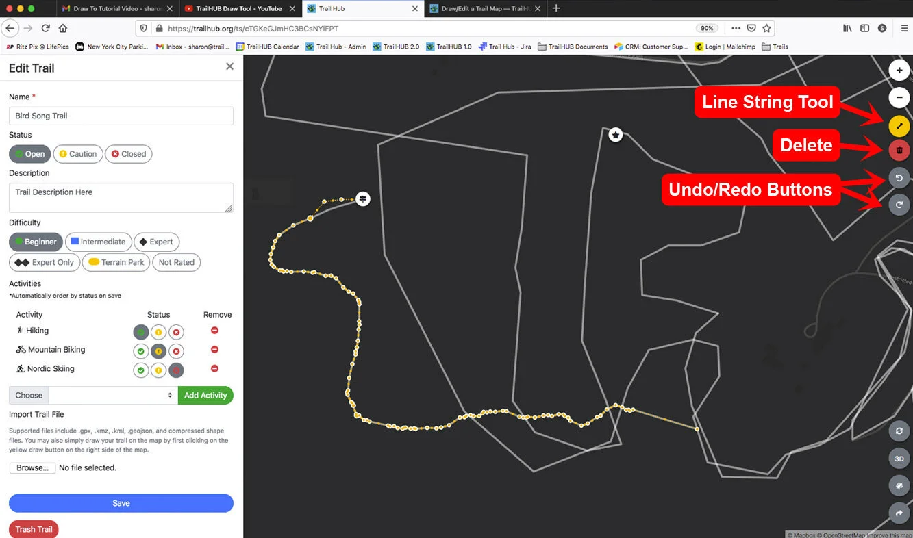
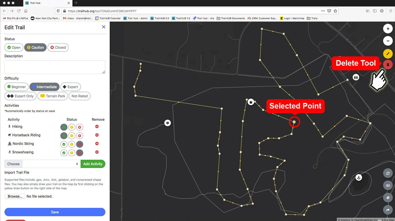
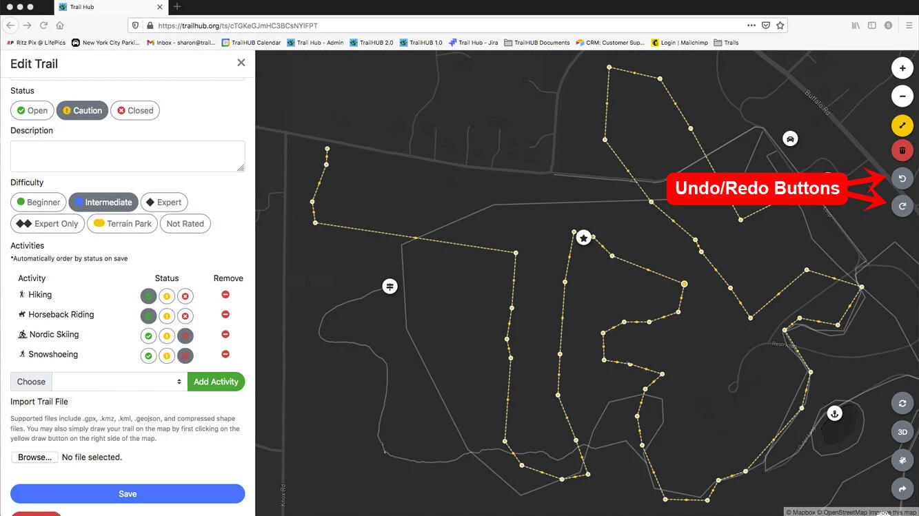
While you are creating or editing a trail, the map switches to a dark style and the right edge of the map shows the line tool, a trash button, and Undo / Redo buttons (the last two appear once you have made a change). Your other trails are shown as faint gray lines for reference.
#Draw a new trail
Use these steps for a trail you are creating, or for an existing trail that has not been mapped yet.
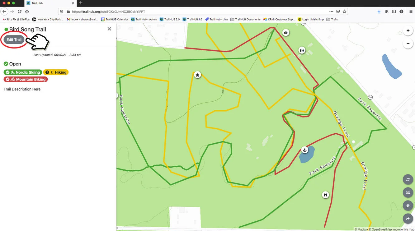
In the Trails menu, click New Trail, or click an existing trail card and then Edit Trail.
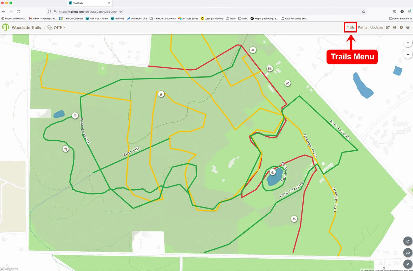
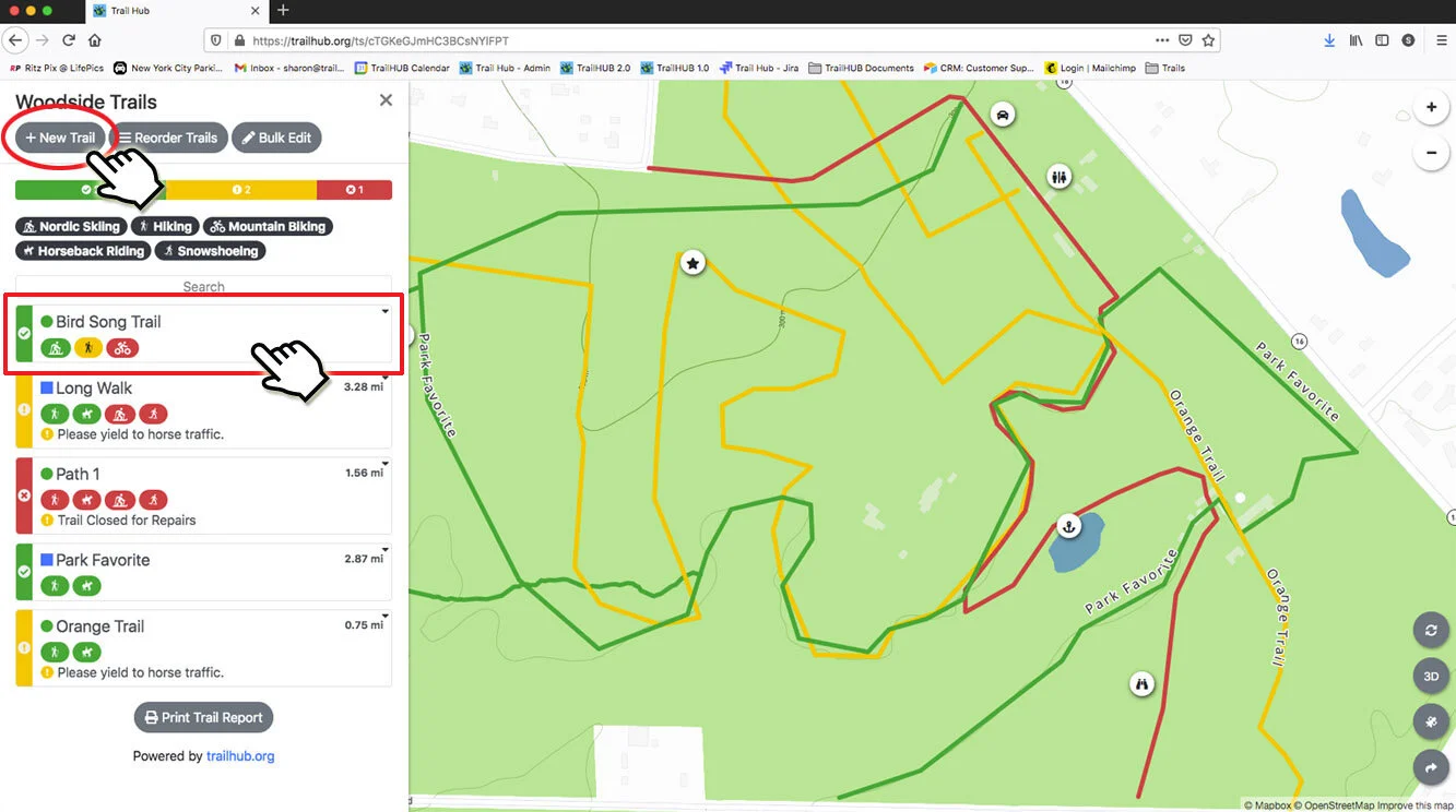
Zoom in to the area where the trail runs.
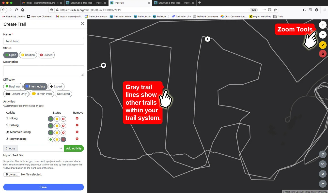
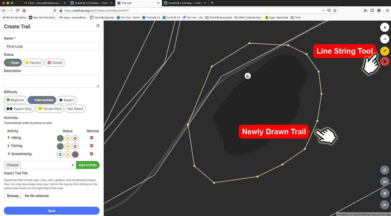
Click the line tool, then click along the trail to place points. The line appears as a series of orange points.
Double-click to finish the line.
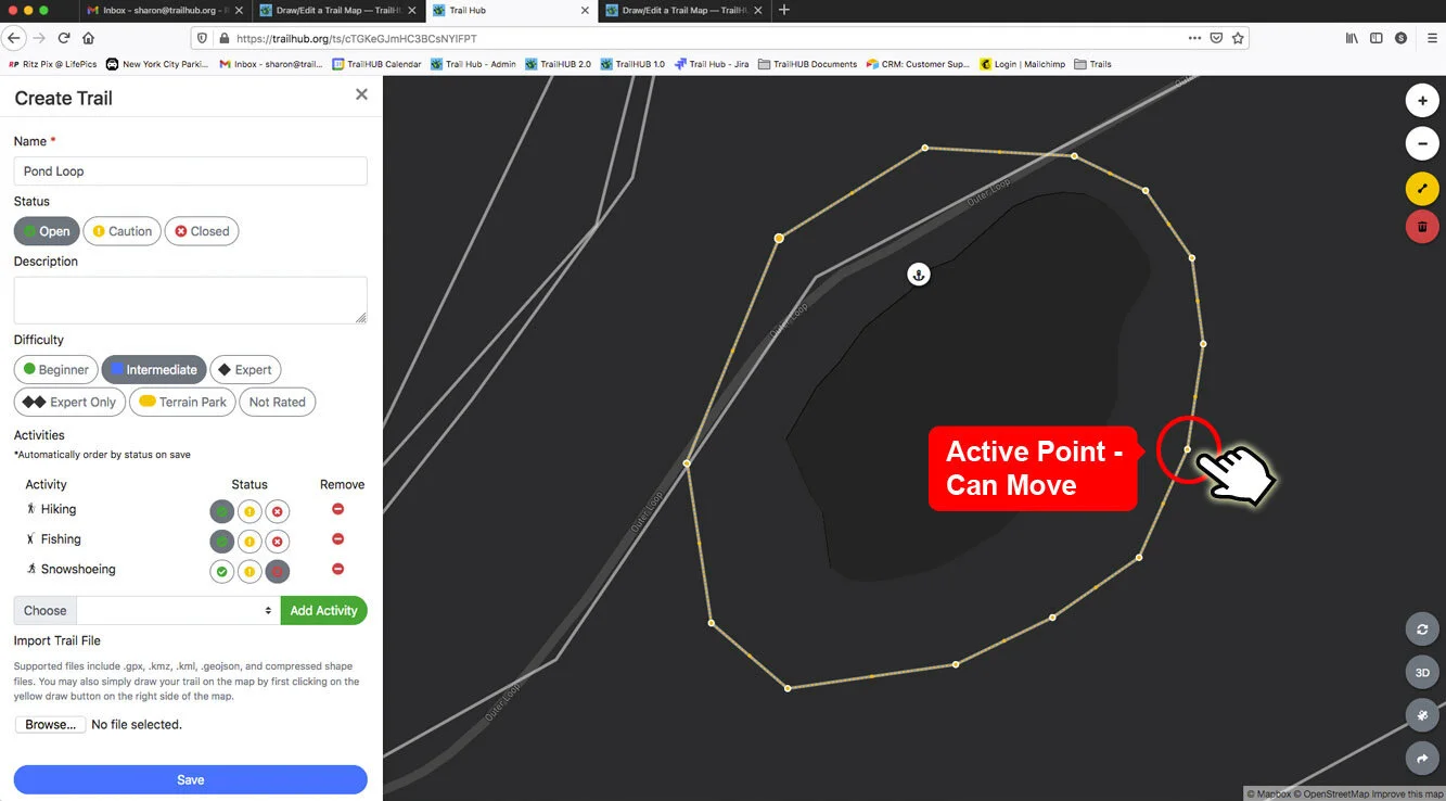
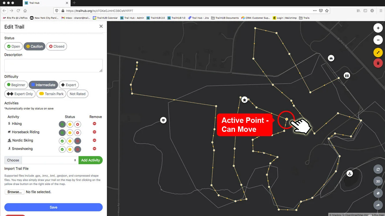
Move a point by dragging one of the larger orange circles.
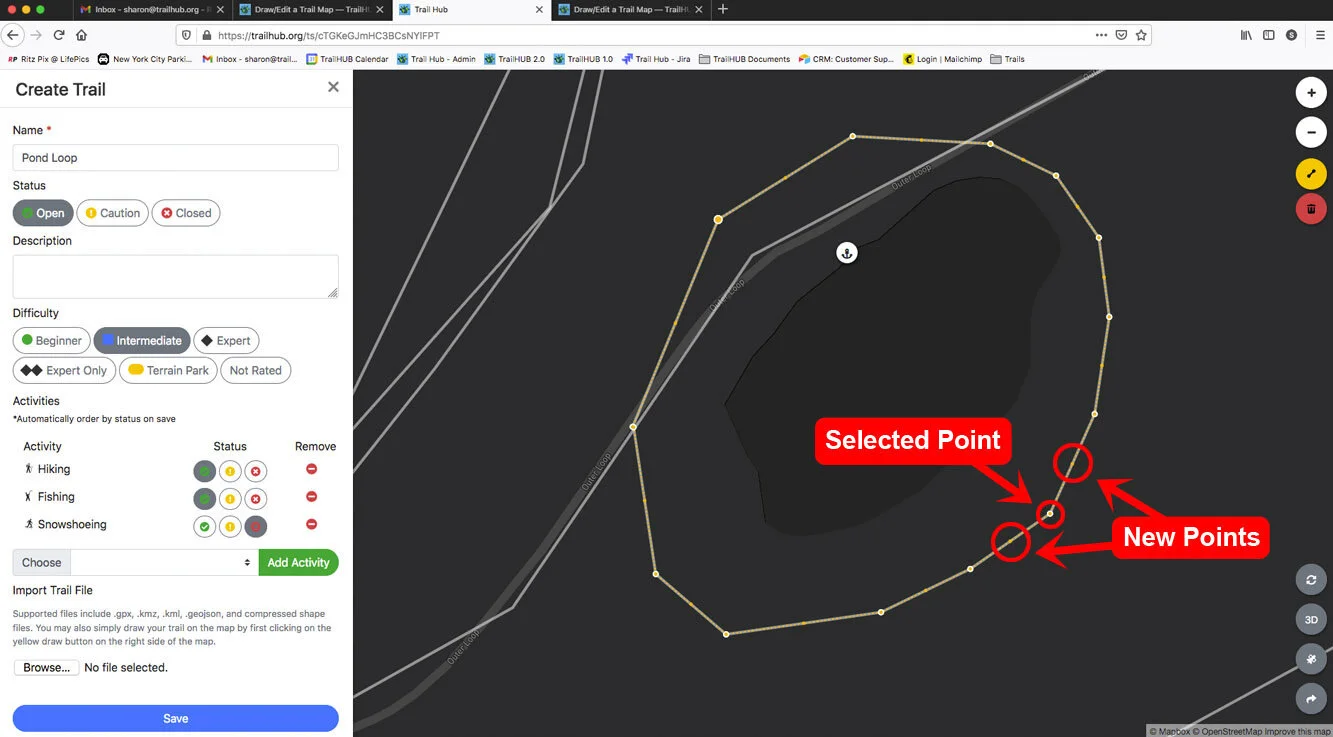
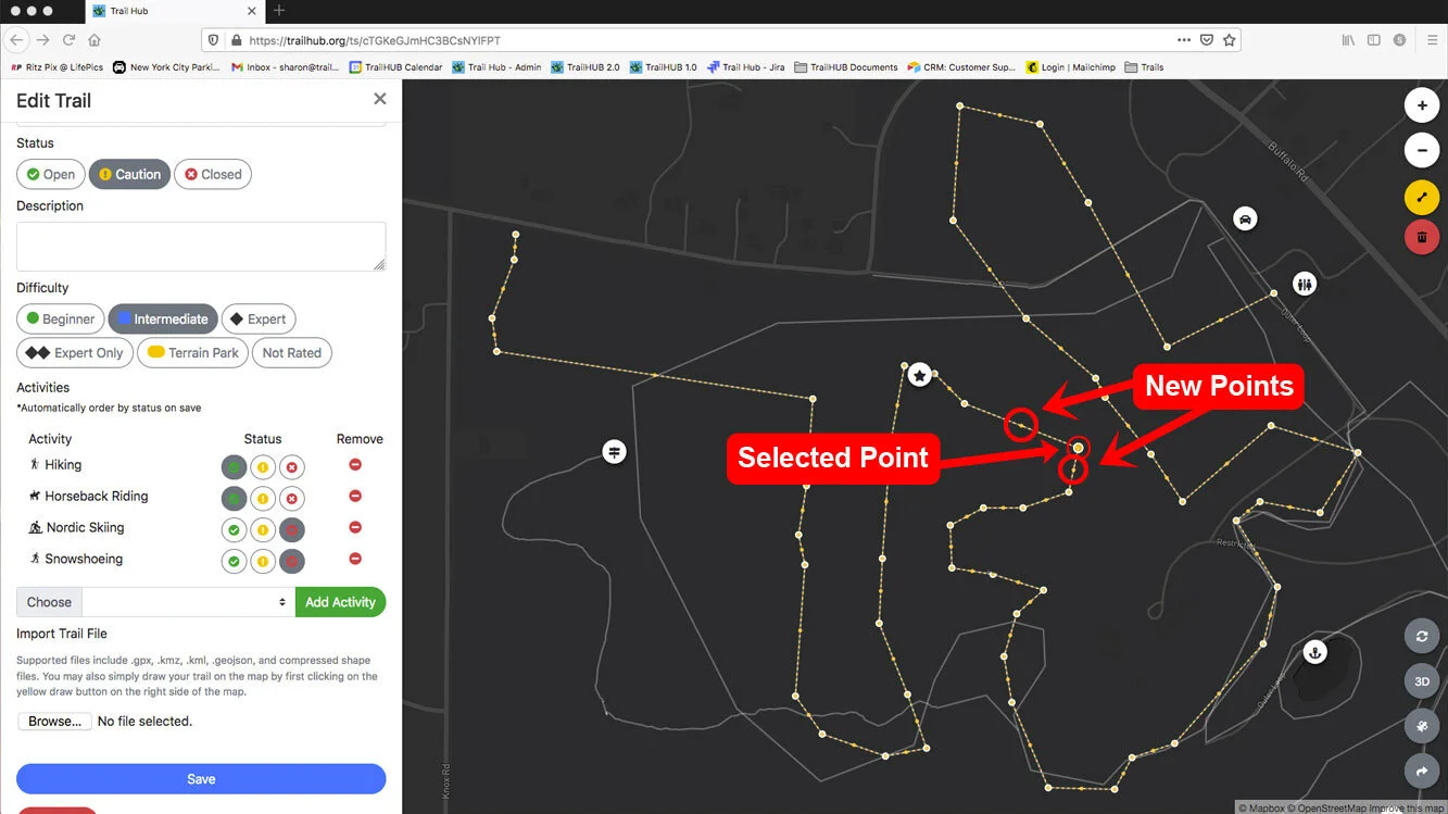
Add a point by clicking one of the smaller midpoint circles between two existing points, then drag it into place.
Delete a point or the whole line by selecting it and pressing Delete on your keyboard or clicking the trash button under the line tool.
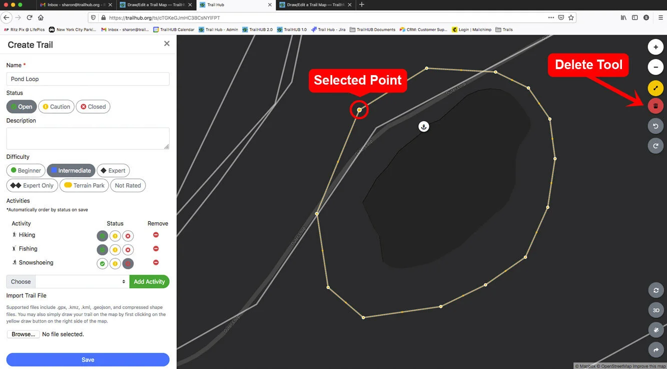
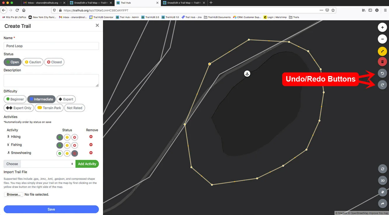
Undo or Redo changes with the buttons on the right side of the map. Up to 20 steps are kept.
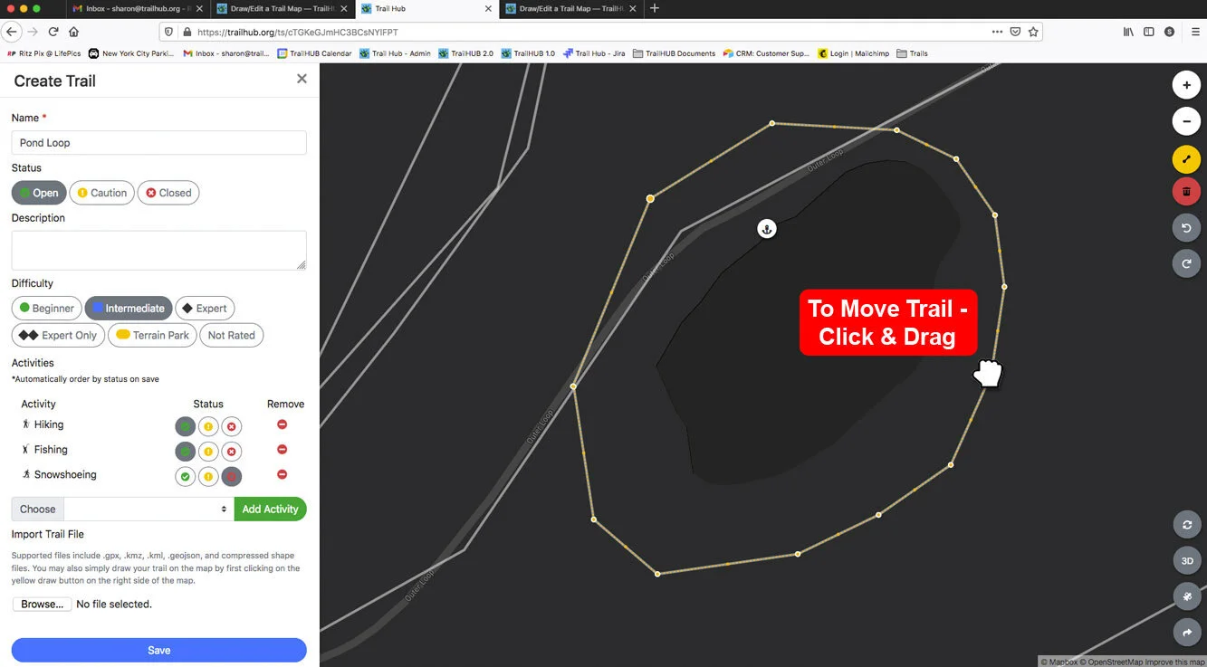
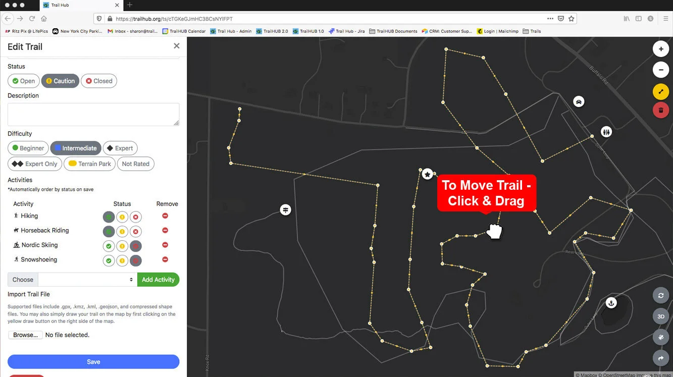
Move the whole line by selecting it and dragging.
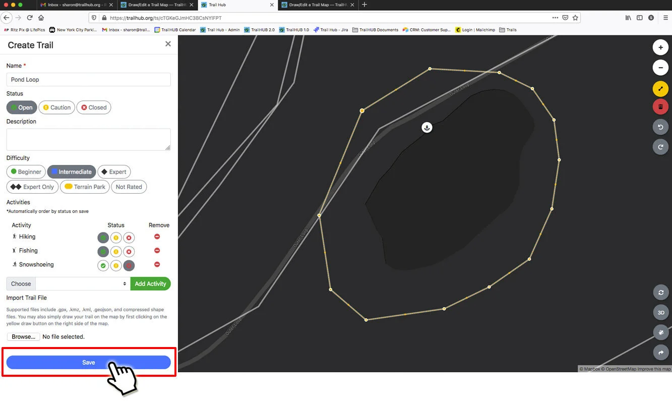
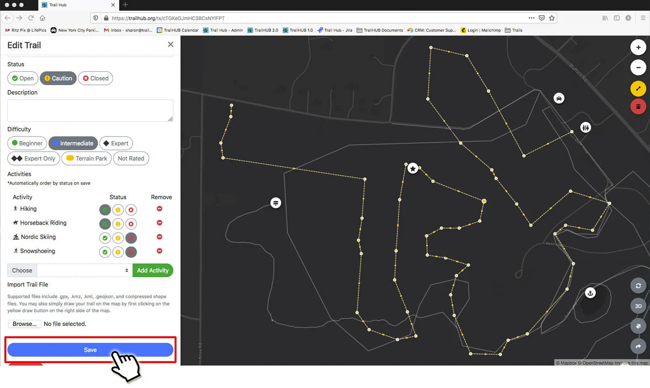
Click Save.
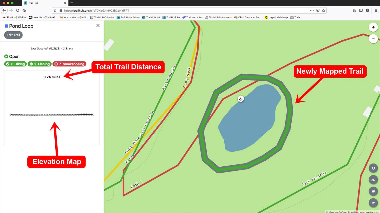
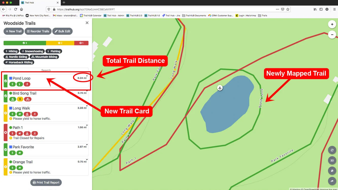
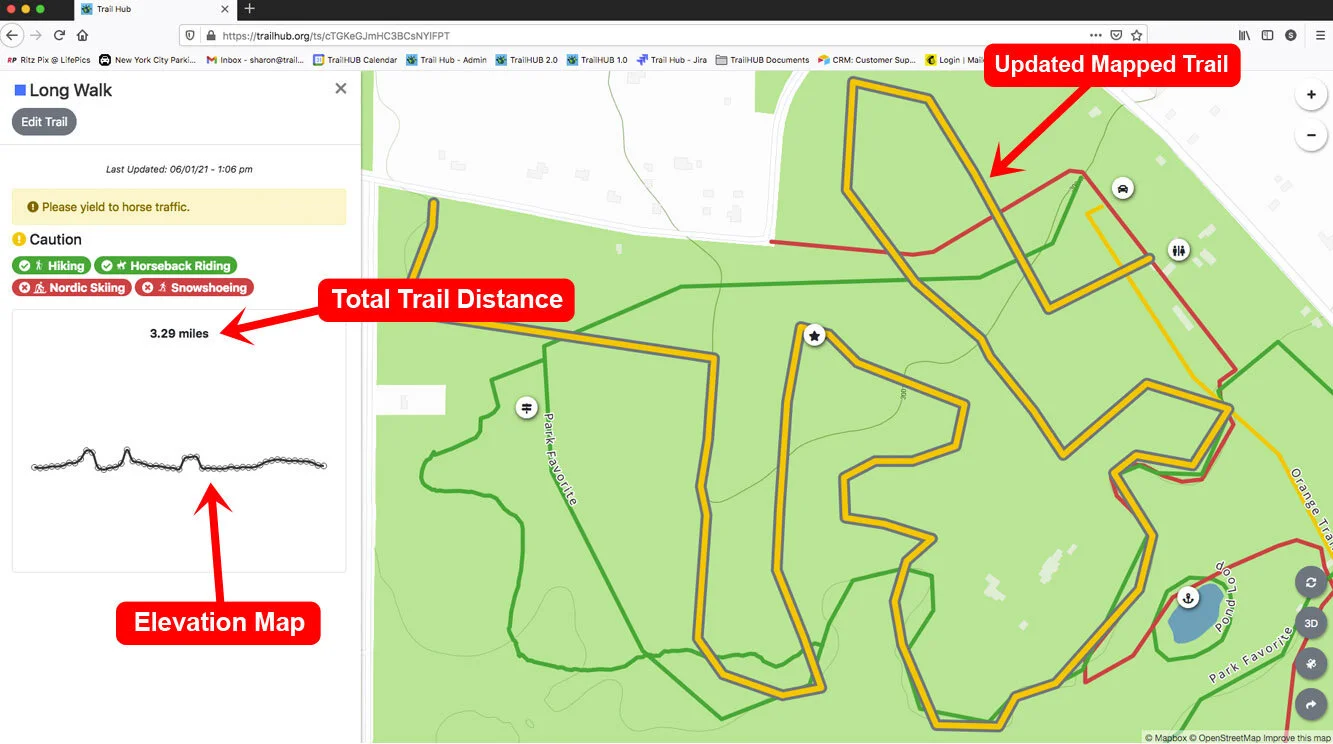
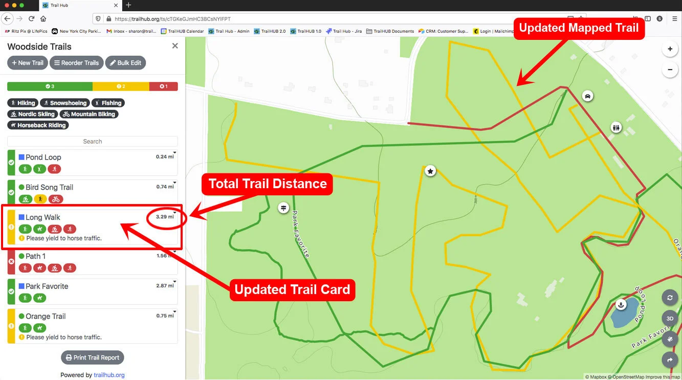
The map returns to its normal style. The trail's distance appears in the detail drawer and on the trail card, and the elevation profile is generated shortly after saving.
#Edit a trail that is already mapped
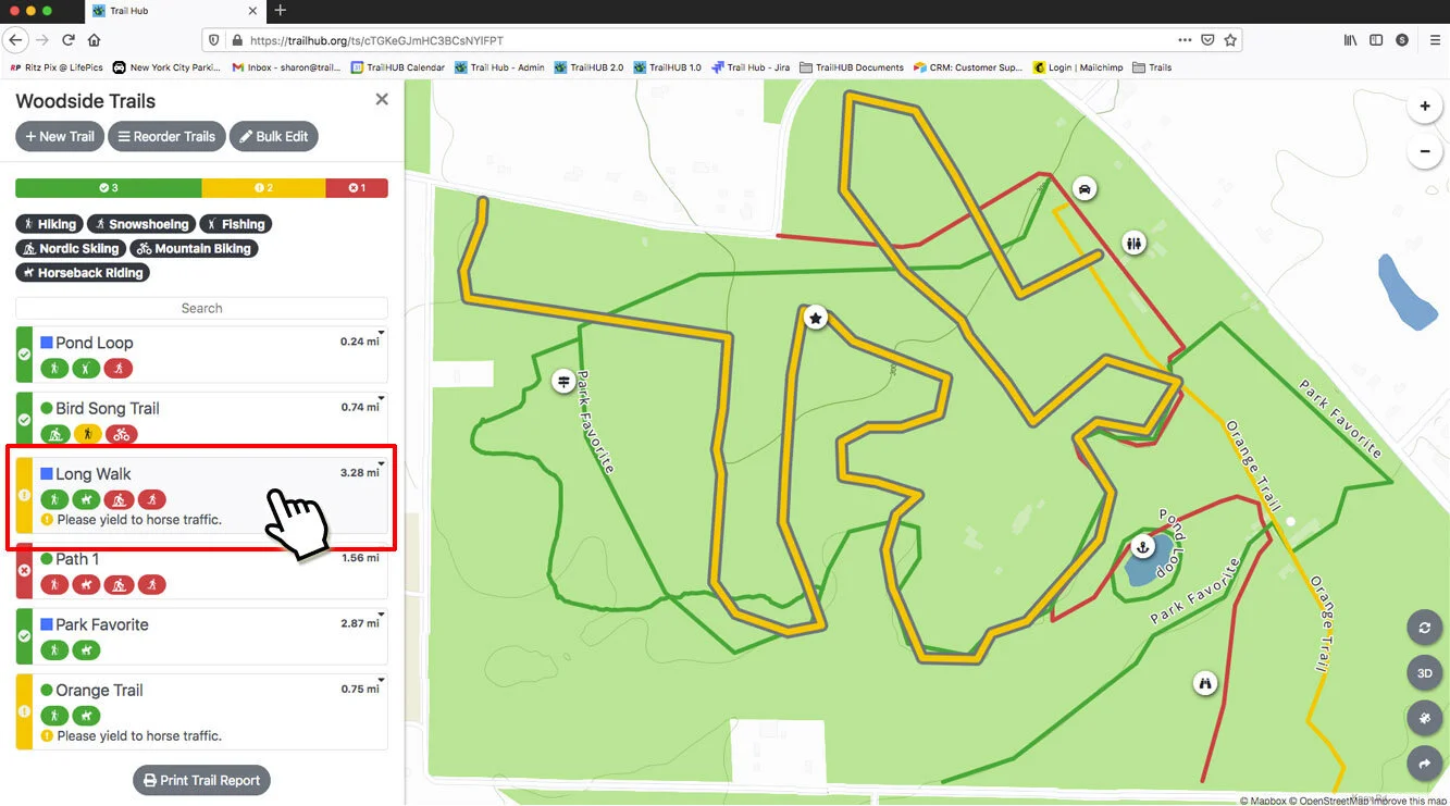
In the Trails menu, click the trail card, then click Edit Trail.
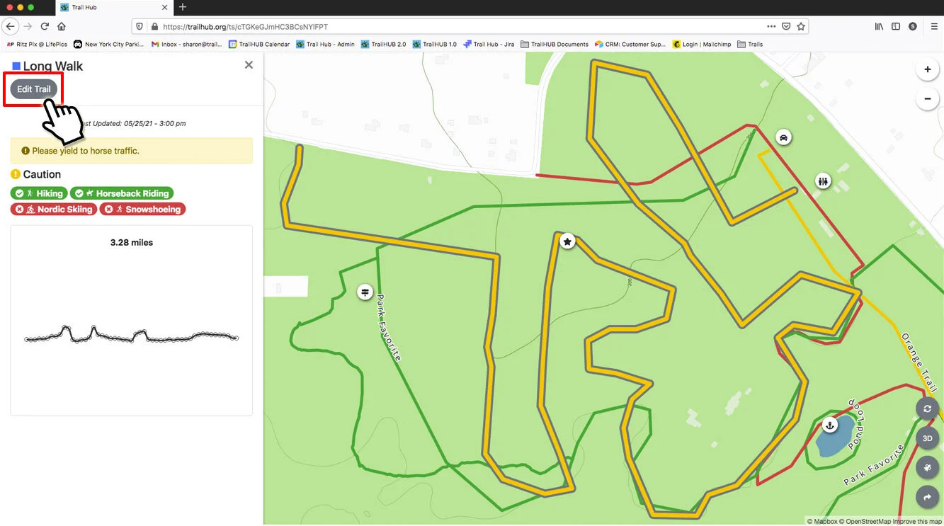
The map zooms to the trail and shows it as a blue line; other trails are gray.
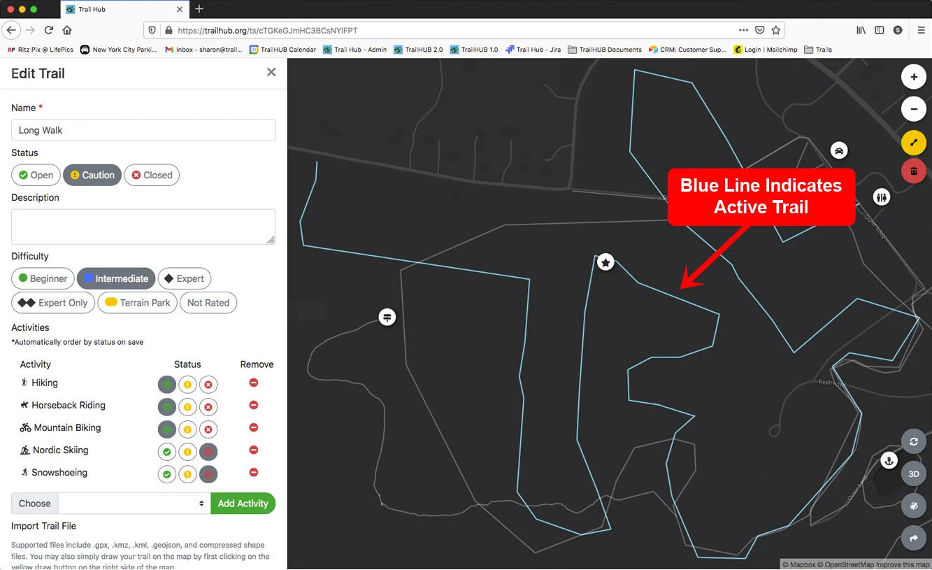
Click the blue line to start editing. The line turns into a series of orange points.
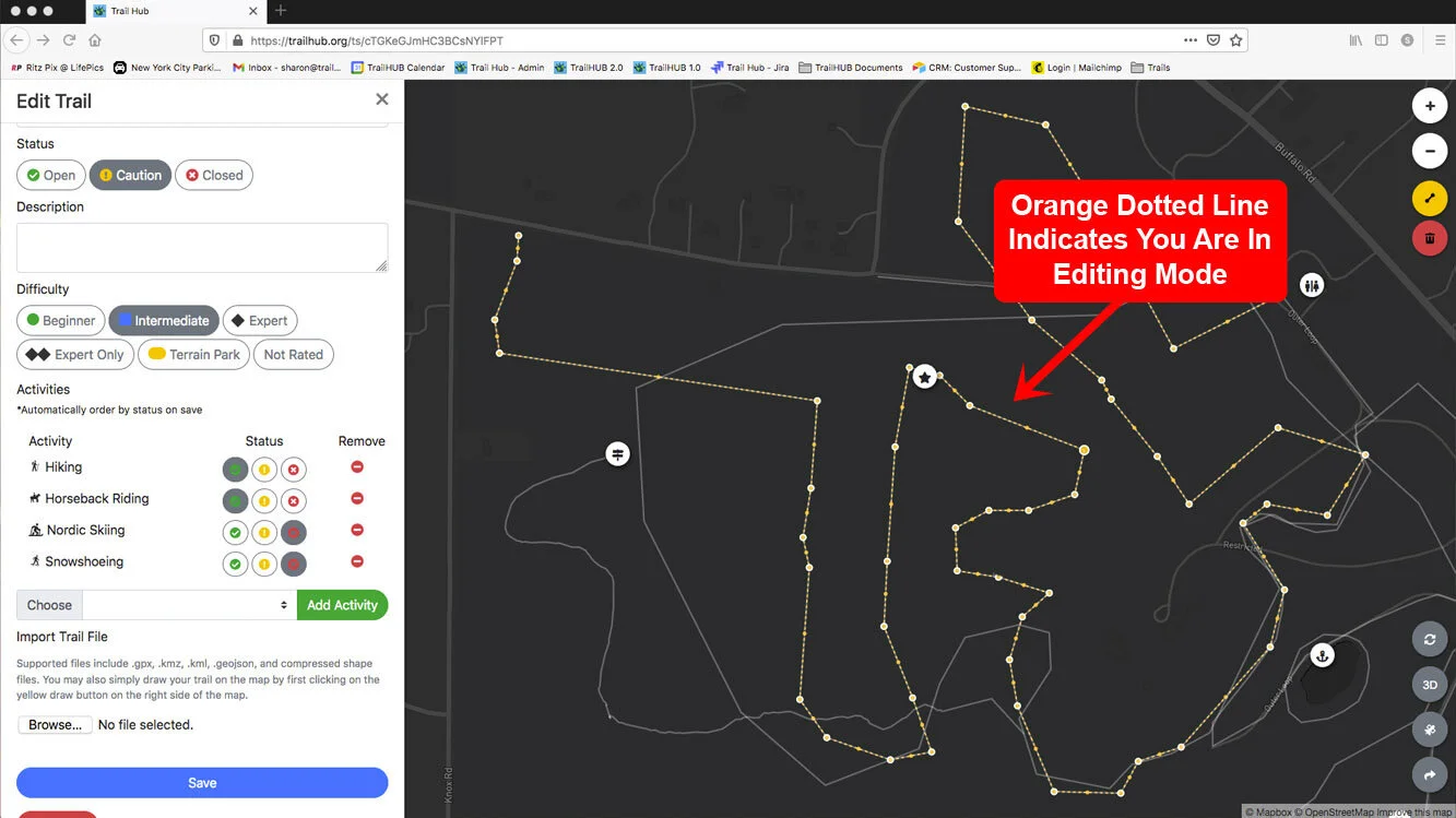
Move, add, and delete points, move the whole line, and use Undo / Redo exactly as described above.
Click Save.
Any change to the line recalculates the trail's distance and triggers a fresh elevation profile.
To replace the line with an uploaded file instead, see Upload a trail file.